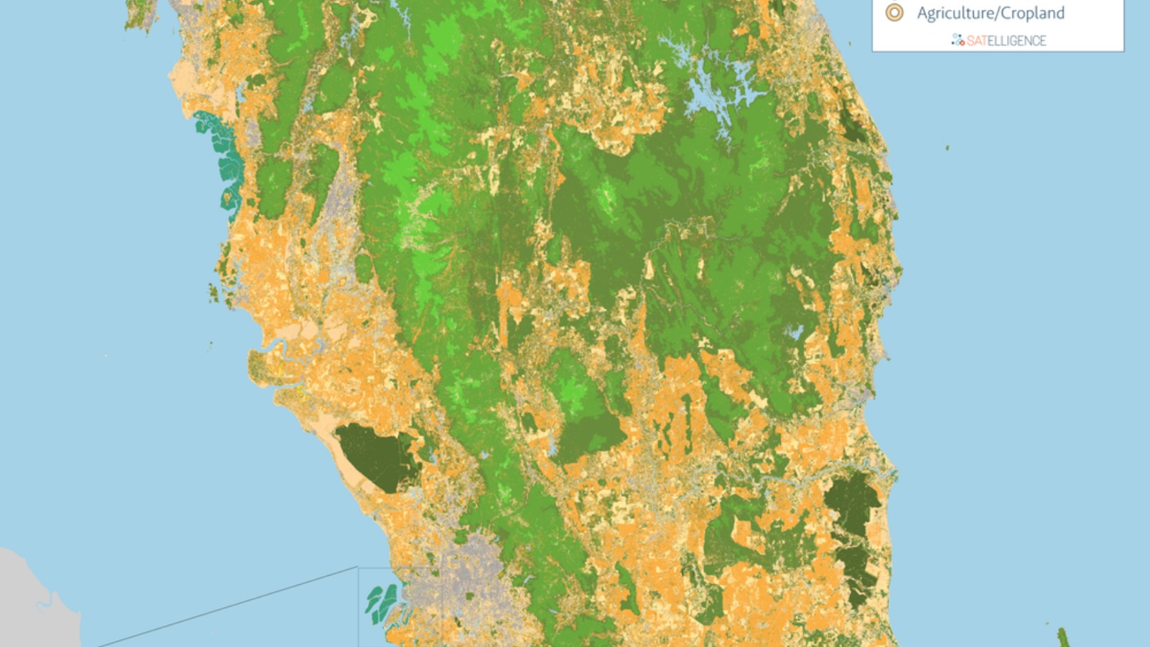
As early as 2016, GIS expert and lifetime environmentalist Niels Wielaard founded Satelligence to warn corporates of environmental risks and opportunities along their supply chains, from farms and plantation concessions to mills and silos. The company combines satellite imagery, AI and machine learning to deliver a precise tool for assessing deforestation, forest fires and other forms of ecosystem degradation at the source of consumer supply chains.
Accurately tracking cultivations of the most in-demand foodstuffs known to provoke deforestation, palm oil, soy and cocoa, Satelligence’s tool is gaining traction as consumers increasingly demand that products are sustainably sourced. In near real-time, via app or data feeds, Satelligence users receive environmental alerts, measurable progress reports and science-based responses to complaints related to the more than 6bn hectares of plantations collectively monitored by Satelligence.
The Utretch-based startup has a high-profile roster of clients, including some of the world's largest food producers Nestlé, Unilever, Cargill and PepsiCo, all of which are major palm oil buyers and which use the cloud-based platform to monitor their Southeast Asian supply chains. Other major customers include the World Wildlife Fund, banks such the Inter-American Development Bank and Rabobank, as well as the Dutch Ministry of Foreign Affairs.
Noting that current technology isn’t being applied "on the level that it should,” Wielaard told media: “In the most widely used information by NGOs, only 6% of deforestation in cloudy areas such as Ghana is detected on a real-time basis. If we add radar that can see through clouds, we can vastly improve the timeliness of the detection. In terms of biggest risk areas, we have only started to look at the problem.”
ESG reporting support
Besides the business opportunity in consumer PR, financial institutions and corporate shareholders also increasingly insist that companies have a public sustainability policy, with a strict environmental, social and corporate governance (ESG) criteria, and where weaker or compromised areas would need demonstrable improvements. This led Satelligence to develop outputs such as actionable deforestation risk reports in formats that are accepted in the boardroom, meaning clearly illustrated data expressed in graphs.
"We provide companies with reliable information, but we do not take the place of the judge. It is important that stakeholders can use our independent information to demonstrate where things are going well, too,” Wielaard told Dutch media.
Satelligence currently has over 60 major clients and 24 staff. Its latest deal involves monitoring the commodities of a coalition of nine international asset managers, including Fidelity International and Nomura Asset Management, which together manage €1.8tn worth of investments. Also recently, US snack giant Mondelēz International said it would be using Satelligence to monitor all palm oil concessions supplying the company's mills, ensuring that none incur any reports of grievances by the start of 2021.
Other 2020 projects include the development of a national monitoring system for sustainable palm oil development in Guatemala in collaboration with the nation's palm oil growers' association, and the monitoring of Surinam's rainforest – some of the world's last remaining untouched tropical forest.
By the end of this year, Satelligence expects to cover 80% of global palm oil production – its most in-demand commodity at present – followed by soy and cocoa. Fire risk analysis will be the next feature released, with deforestation forecasting on the cards for future development. The startup raised its first external funding in November 2020 to finance these developments, securing $2.3m from Dutch social impact investor 4impact and the EU's innovation grant program Horizon2020.
Clouds and haze
Satelligence works by accessing public satellite data from three sources: Sentinel-1, Sentinel-2 and Landsat. Cloud cover is a major obstacle to surveillance in the tropical areas Satelligence monitors.
“One way of dealing with this is to use Sentinel-1 radar that can ‘see’ through the clouds and haze,” Wielaard said. “We also had to implement an automated cloud removal and tedious haze-correction process to clean up all usable pixels of Sentinel-2 imagery, collected every five days throughout the entire year.”
The images are at a resolution of 10 meters and are recorded either daily or a minimum of bi-weekly, according to requirements. Satelligence's sensor-agnostic system combines the different satellite data in the data cloud where image processing algorithms are applied, identifying patterns, for example, of different plantations or types of forest in the landscape. Additional superpixel features allow for the differentiation between natural forest or plantation canopies.
Radar signals that come back from forests are a higher frequency than signals that come back from deforested areas, meaning anomalies can be flagged over time and measured. As the satellite datasets go back to 1986, historical information can be used to compare landscapes and determine the long-term health of forests, with machine learning aiding the detection of changes to the landscape.
Applicable across industries
Satelligence achieves more than 95% accuracy in results, thanks to its combined use of three satellites' data and processing algorithms developed at Utrecht's University of Wageningen, where Wielaard pursued a master’s in Forestry with a specialization in Remote Sensing. Relevant data is then filtered out for each client using a prioritization algorithm.
Severe environmental risks, such as fire damage or flooding, are easily identified. Though Satelligence currently applies its technology for monitoring food production, one of its first projects examined flood risk in Myanmar. The technology can be adapted to any change on the Earth’s surface or even in the atmosphere. The sheer amount of data converted from raw satellite feed to pixel-level change detection means hundreds of thousands of separate satellite images need to be preprocessed, aligned and then processed with a change detection algorithm, requiring processing in the cloud.
Another essential factor for Satelligence is human intelligence, and for that reason it has field offices in the areas it monitors, currently including Bolivia, Indonesia, Ghana and Tanzania, with plans to establish more.
The offices function as networking points to liaise with all relevant stakeholders, including local growers, traders and legislators, and to provide local intelligence on regional environmental risks. They are also important in the case of monitoring downstream operations, though Satelligence's near real-time monitoring reduces the need for in-situ ground checks.
Profit for sustainability
Wielaard is keen to point out that his technology is not only there to name and shame environmental abusers but also to spread awareness of decent environmental custodians.
“We see that in the palm oil sector, where we are collaborating with several companies who are working really hard on the ground to make life better for local communities while also producing sustainably and eradicating deforestation,” he said. "But it's really hard to get their story to the consumer."
Wielaard sees a profit-based business model as central to success in corporate sustainability. Satelligence’s technology is charged on an annual subscription basis according to the area of cultivation covered.
“Services have to be more sustainable over time, he said, explaining his preference for a for-profit model with an impact vision.
“Making sure that we help create a better planet with all the right intentions, via a for-profit model, makes the most sense, especially now we also see that financial institutions are actually going through a kind of a green revolution.”
