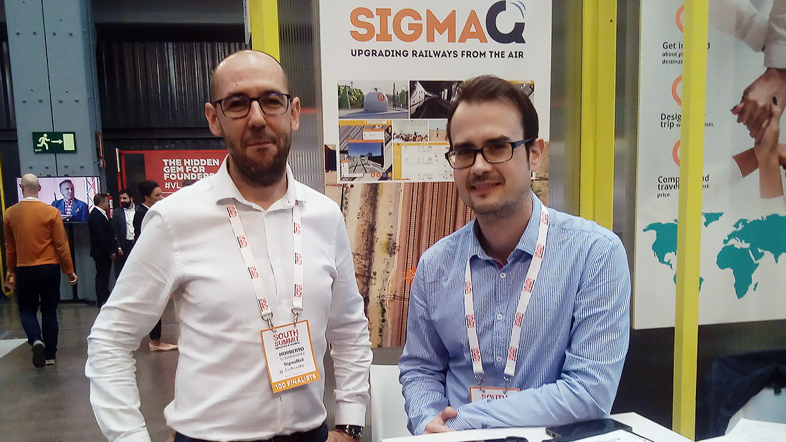
It now counts Siemens and Thales among its biggest clients, and has expanded to markets in Singapore, Morocco and possibly soon, Mexico. Founded in 2016, SigmaRail is a Madrid-based startup running advanced railway engineering services, namely digitizing railway infrastructure using drones and LiDAR technology. It creates digital models that can be used to provide the geographical locations of railway resources worldwide. An algorithm processes the real-life data captured to produce digital maps of train tracks.
The company also uses a computer vision and image recognition software that was created in collaboration with the UC3M Intelligent Systems Laboratory at the Carlos III University in Madrid. The data is analyzed and made available to engineering companies for various uses, such as facilitating automatic railroad inspections, geolocating potential incidents on rail corridors, reducing costs and increasing train safety. The co-founders are passionate about innovation, state-of-the-art technology and engineering in the railway and unmanned aerial vehicles (UAV) sectors.
CompassList interviewed co-founder Mario Fernández Marín at the 2018 edition of the South Summit in Madrid, where he shared about the company's key technologies, services and milestones; business model; and financing and expansion plans.
Fernández, a telecommunications engineer and graduate from the Polytechnic University of Madrid, is also SigmaRail's product manager.
This interview has been condensed and edited for clarity.
Q. How did you get the inspiration to build SigmaRail?
A. Well, we were three co-founding partners from the same university. Norberto and I met while living in France. [Note: Sigma Rail's CEO Norberto González Díaz has a master's in Electrical and Thermal Engineering from the Polytechnic University of Madrid.] Jorge López Sánchez and I were Erasmus friends at the same university. He graduated in Industrial and Mechanical Engineering.
It all started when we asked ourselves what the needs of the market in the railway sector were. Backed by our years of work experience, we detected one of the needs, we proposed a technical solution and we went for it.
Can we say then, that the solution came before the foundation of the company and what solution are you providing?
The solution came before the company, yes. We started to mature the solution about a year earlier, towards the end of 2016. We were all living abroad. I was in England, Norberto was in Côte d'Ivoire and Jorge was in Australia when we decided to return to Spain to form the company and start its production.
We always say that we are producing the Google Maps of the railroad. High-speed train employees need to know where things are along the railway corridor. For example, the drivers need to know what is out there to be able to brake on time, if there is a curve or before entering the railway station. What we do is to give precise data to indicate the places where accidents can occur. So trains can be safer, more frequent and give better services.
For this, we use innovative technologies such as drones and laser to produce 3D prints that show what is in the corridor everywhere. On the other hand, we collect so much information that we are making it available to other utilities such as maintenance, security; and also to other markets such as highways, or oil and gas.
What have been the main milestones, successes and difficulties since the foundation of SigmaRail in 2016?
Half a year after we started, we were selected to join the European Space Agency (ESA) incubator program, specifically for the Community of Madrid-Node UC3M. By then, we had the solution quite matured. The next important milestone was to have real references because one of the differences that usually exist between engineering companies and startups is that the latter do not have real references.
For example, we have covered the Madrid-Murcia high-speed line by providing rail assets geolocalization with a drone-based data capturing solution, in collaboration with Spanish rail company CAF. We have also participated in a project in Barcelona. This time we covered the R1 commuter line with Mobile Mapping techniques in collaboration with Alstom, the French rail multinational. In another between Casablanca and Tangier, we produced a laser-based data capturing solution.
Other success stories include the fault detection tests carried out in the Madrid-Seville high-speed line in collaboration with Thales and Adif, two of the biggest names in the sector internationally. Also, the consulting work carried out in Singapore on the East-West and North-South subway lines.
We also became profitable and doubled the number of projects in the second year.
What are your sales numbers and plans for the near future?
We expect to have a turnover of €2 million in two years. Today, we are at approximately between €200,000 and €250,000. Our idea, right from the beginning, has been internationalization. This year, we have already achieved it with projects in Morocco and Singapore. But we want to increase our scaling in this area. In Spain, we have projects, but we want to improve our position to reach all the great players; even including other sectors such as roads and oil and gas.
Our plans are made for approximately two years. So, in the next two years, we want to consolidate ourselves in the international rail market and expand to other sectors nationwide in Spain.
Who are your major clients and are they paying customers or trials?
They include Siemens that sells energy systems and Thales, a French multinational security electronics company that produces products for aircraft and trains. They are paying customers. Both Jorge and I have already a history in the sector, so we have contacts and we know the market.
What is SigmaQ?
SigmaQ is our star product. It is an integral solution that includes a geographic information system (GIS) platform that captures data for mapping through laser, drones, front cameras and automatic data processing with machine learning algorithms. With SigmaQ, we provide meaningful information to make decisions based on the actual status of the infrastructure. Data is accessible through the GIS interface.
Can you tell us about other products?
We have different data capturing solutions that can be offered according to the needs of the client. Some want drones and aerial views, others want laser with a 3D digital model where the laser is placed on the train and produces a cloud of dots (LiDAR, or Light Detection and Ranging technology). It works by emitting a beam of light that bounces off and returns. When you do it many times in a second, you get a 3D landscape. This system has a lot of precision. We also have a front-cameras solution, in which the cameras are also placed on a train.
They are really three modules within the same solution. In addition, you can also equip a drone with the front cameras.
Does this mean that there are three data capturing solutions that produce similar results?
The answer is, yes. The point is that there are times, as was the case in the Barcelona project I mentioned, that we could not use drones due to the number of tunnels that exist along the corridor. With the different data capturing solutions, SigmaRail offers a wide range of technology for different projects according to the needs of topography, location, maintenance and security. For example, laser gives you a lot of precision and is used for maintenance, but there are other functions for which such precision is not required.
What are the advantages of combining drones and LiDAR technology?
Really it is not about combining them, but about having the solutions to reach everywhere. The advantages of the three methods are that they lower costs, increase data reliability and safety because the operators will now have updated information on the state of railway tracks.
LiDAR technology is being explored for use in autonomous vehicles, can it be also applied to the railway?
Yes, most autonomous cars have computer vision. At the moment, we only have it in mind for trains for the medium or long term.
What is your view on the future of digital railway?
Trains will be more efficient and safer for passengers. By more efficient I mean, more frequent services for users. In addition, with more accurate data on the railway corridor, such as those provided by the digital model; there will be fewer failures. As for the rail companies, they will have lower costs and trains will be safer and more frequent because train management will be more precise.
How did you come up with the idea of installing drones along the railway corridor? Are they automated or remote-controlled?
Establishing drones along the railway corridor is our long-term vision. To date, a lot of railway track control is automated, but people are still necessary. In the future, control will be fully automatized. The idea is to have an autonomous system that is capable of data collection, with a person, for example, in the control center, who pushes a button to start each drone or the full system. Ideally, the drones should be autonomous. This is legally possible as there is an aerial corridor of 50 meters high and 25 meters horizontal distance from the linear infrastructure's axis that is legally under the control of the responsible authority that could be used for this purpose.
Could you discuss investments to date and investment plans for SigmaRail?
We are preparing a financing round; however, I cannot give you any details because we are in talks with private funding entities. So far, we have received public funding. Since the ESA incubator program, we have been able to finance ourselves through Phase I of the Horizon 2020 instrument. We have also participated in the NEOTEC program, run by CDTI (Center for Industrial Technological Development under the Spanish Ministry of Science, Innovation, and Universities) to support the creation and consolidation of technology-based companies.
We also collaborate with several partners, such as Esri or Autodesk. These collaborations permit us to use tools such as the GIS system or Autocad engineering.
What is your business model?
Today, we provide services. But we are evolving towards a product model. We focus on data analysis to provide intelligence or interpretation of this data through AI. Our services are provided on a cassette or in digital format, including the state of maintenance and geolocation. So, it could be considered that we sell both services and products. We are also considering SaaS as a possibility in the future.
From what I have read about SigmaRail, your company offers two types of services. On the one hand, the digitalization of the corridor and, on the other, training and consulting services.
Yes, that is correct, although now we do a little training. We are focusing more on data analysis. What happens is that all the elements of our solution have to be quite customized, so engineering and collateral consulting services are always needed to achieve the solution. Therefore, we always have consulting teams, basically, in everything related to railway engineering. We always offer consulting services as part of the SigmaQ package. In addition, sometimes consulting services can be provided independently.
Do you have any competitors?
Georail. But, more than companies, traditional sectors such as topography and security. Or autonomous drone systems, in the future.
Can you tell us about your connectivity and data requirements?
Through our partnerships, we have access to computer software such as Autocad or GIS. For analysis, we use tools like Open Source machine learning. Our advantage is precisely that we are efficient, we save costs.
In remote places, laser and the rest of the technologies transmit signals by GPS without the need for real-time transmission. Data is captured and then sent and analyzed. Therefore, connectivity is not currently necessary, although it would be ideal in the future to have real-time data transmission.
Anything else you wish to share with us about your company?
We are growing at our maximum capacity. Our solution is applicable to all types of railway tracks and infrastructure. Therefore, the market is very large. In addition, it is applicable to other infrastructure or linear works. For example, in the US, we are now exploring a business opportunity with Ferromex from Mexico.


